Town 1275
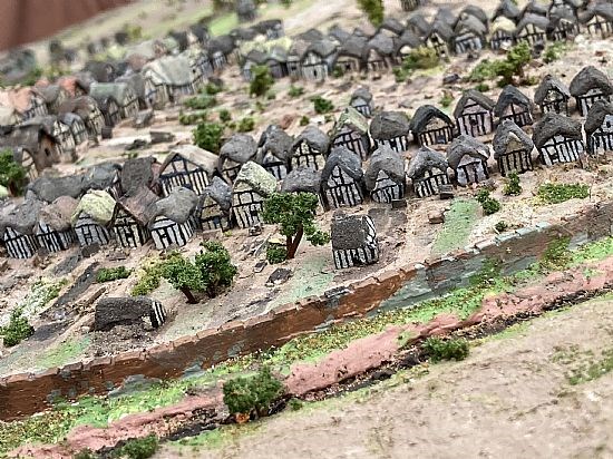
The layout of High Town would be essentially as today with the three streets running westwards from the High Street. Here we see the rear of Whitburn Street realised from the ditch area in front of the western town wall.

Hungry Street looking from the NW.

High Street / future Church Street junction.

Close-up to the rear of the undercroft houses.

Town’s Cross situated at the High Street / St Mary's St junction

Town (timber) barn situated to the rear of where Wetherspoons now resides.

St Leonard’s church with the graveyard wedged up to the (Moat St) town wall

Earliest incarnation of town’s North Gate, seen from the north.

The town’s North Gate seen from within the town.

Whitburn Gate observed from the SW.

Whitburn Gate observed from the north

External views of Hungry Gate with its bridge in front and the bastion (Half Moon) to the left.

Cow Gate looking from the west.

The southern wharfage with warehouse behind the boatyard.

The 12th century timber trestle bridge, spanning across the southern part of the bylet island.